|
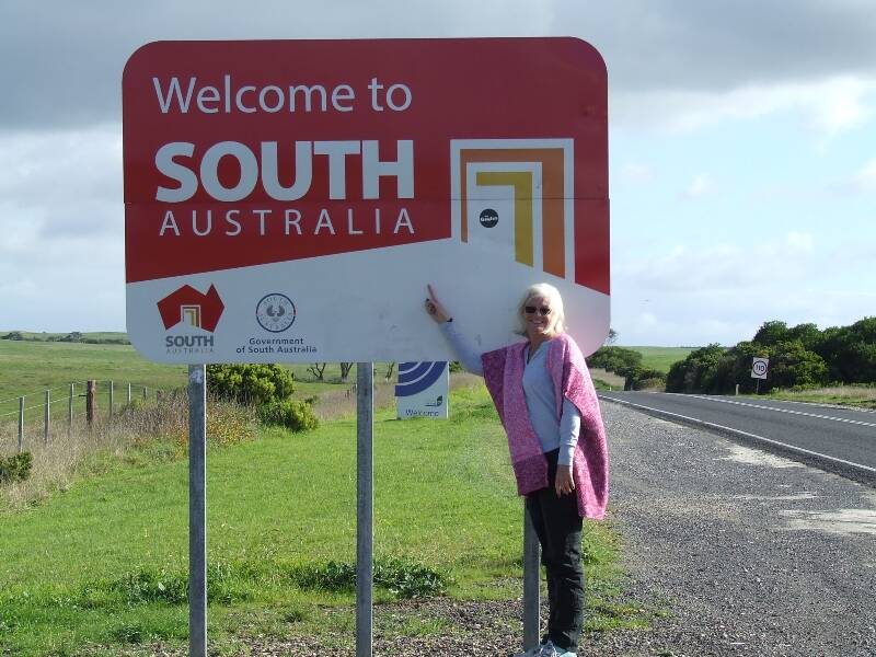
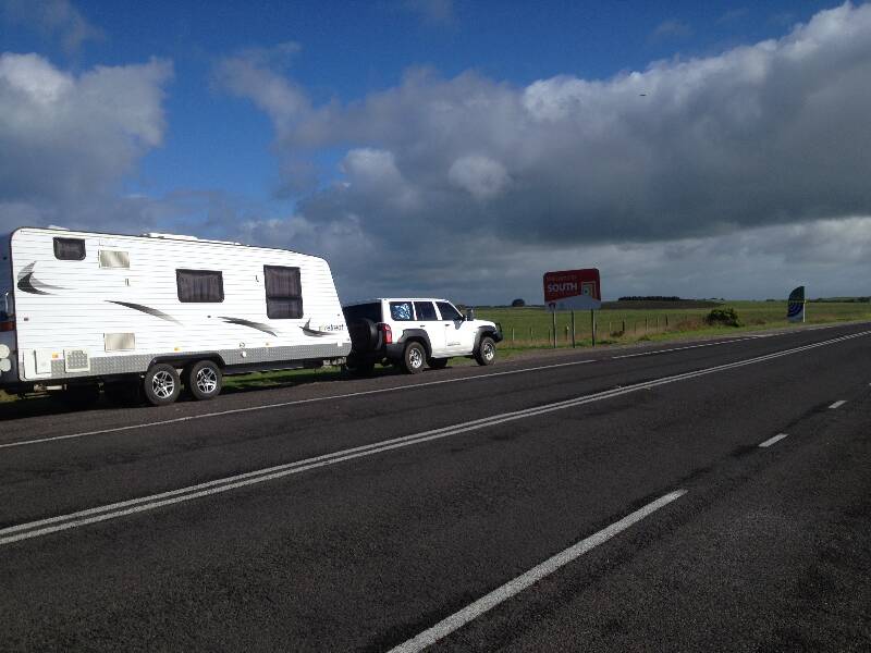
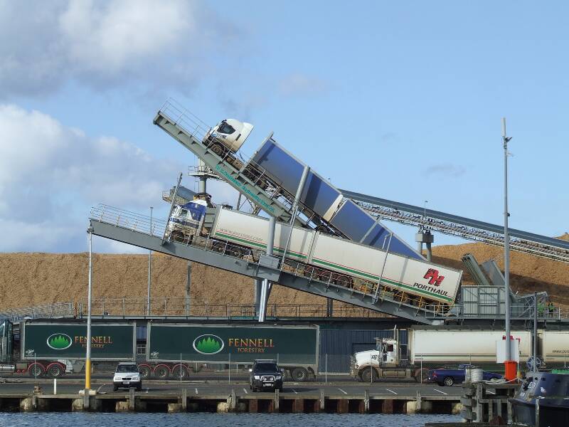
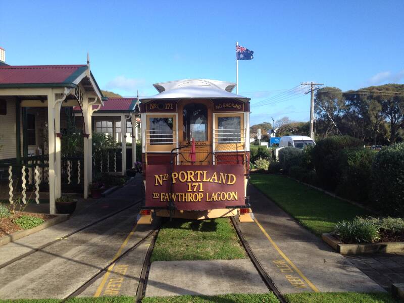
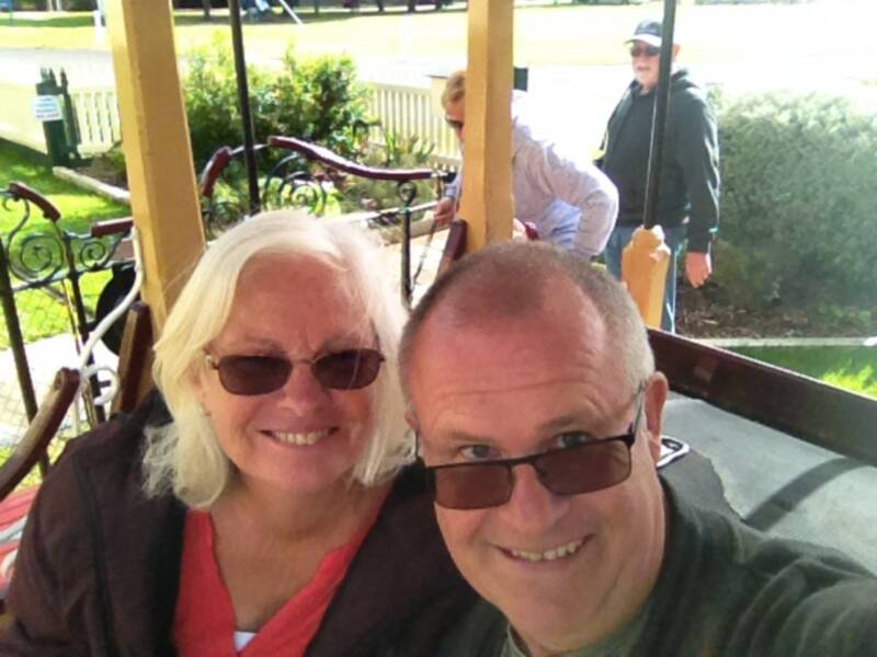
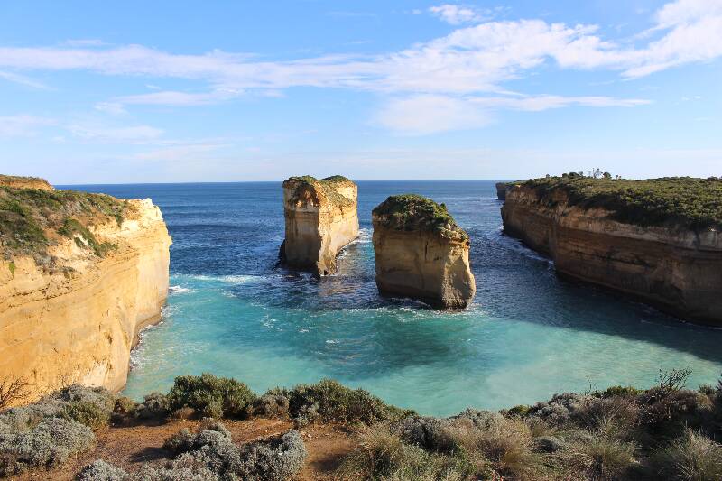
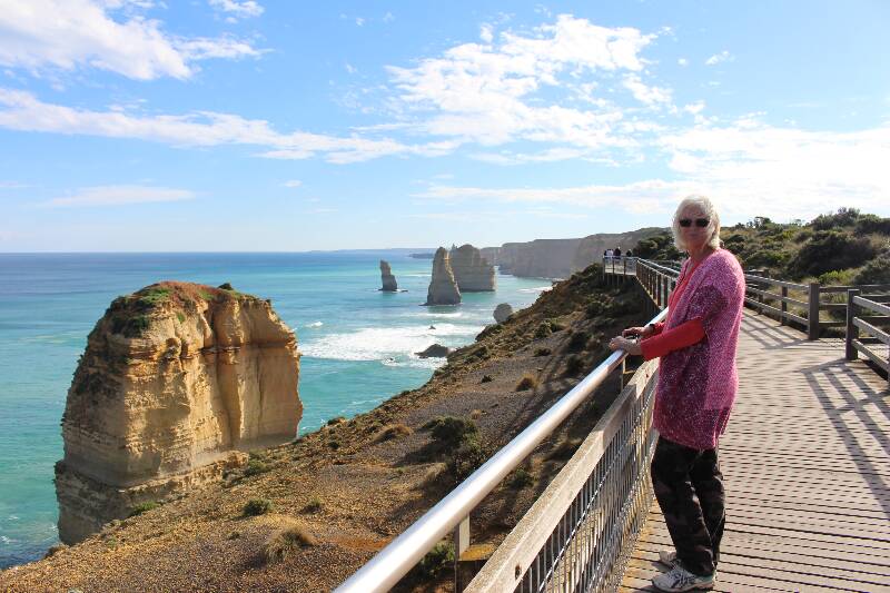
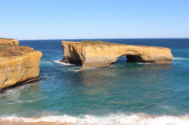
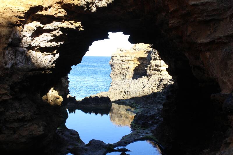
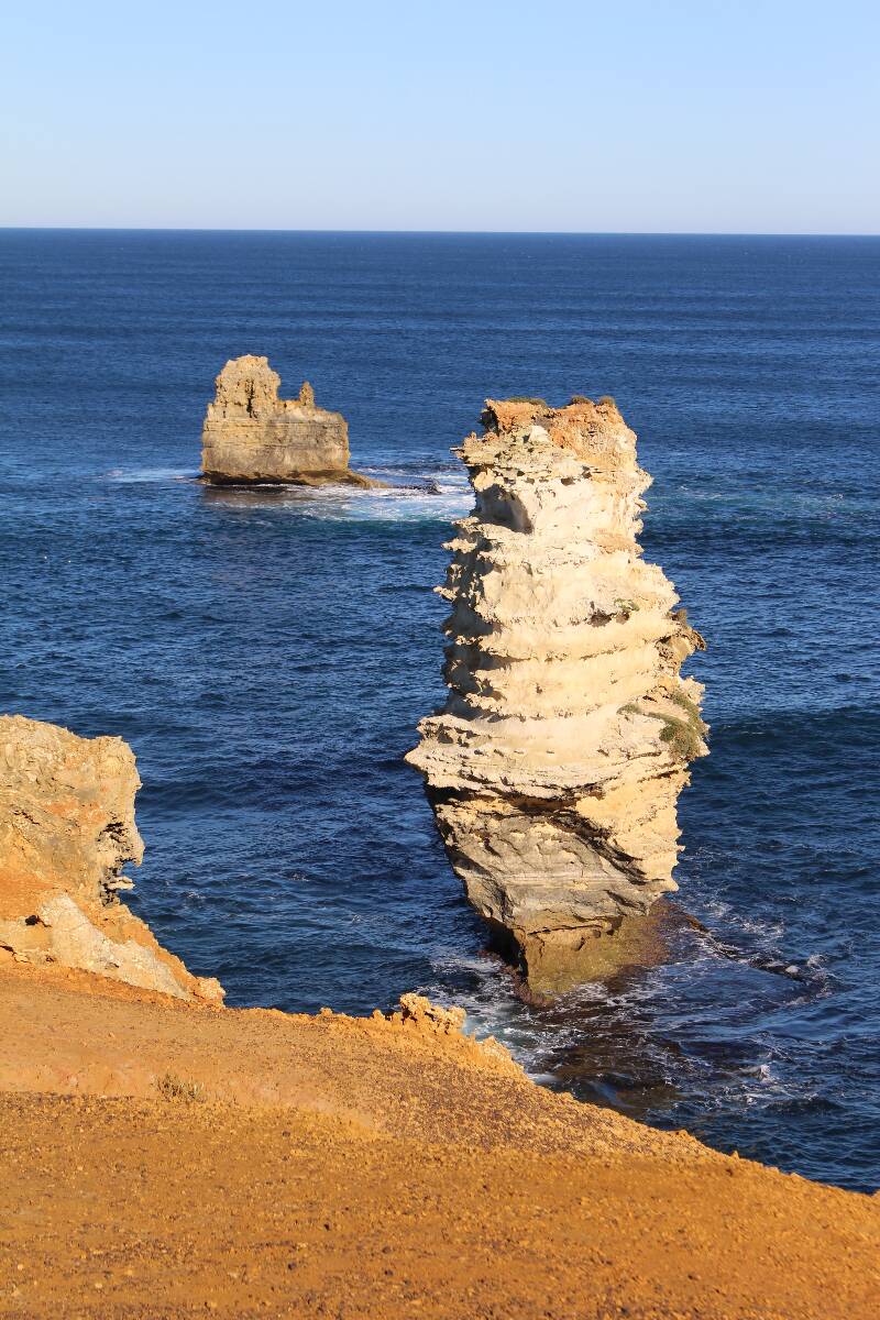
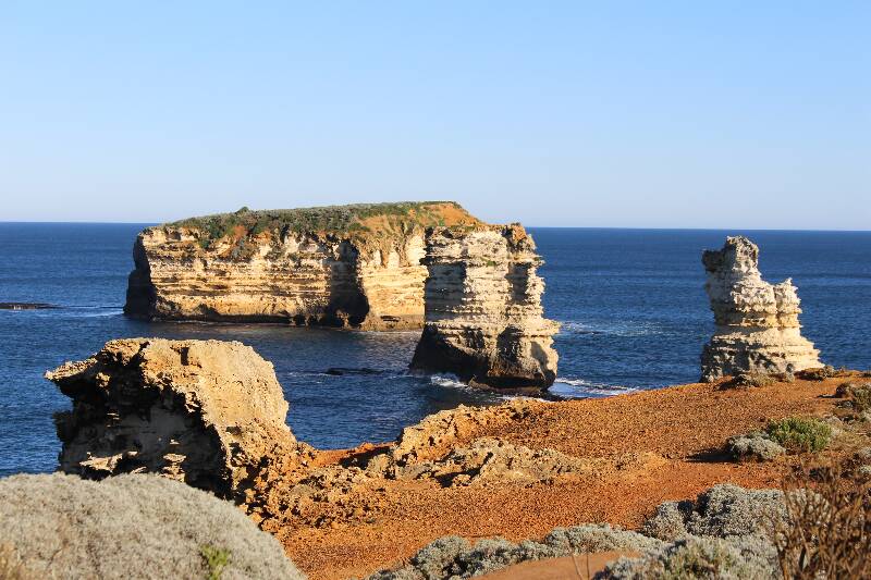
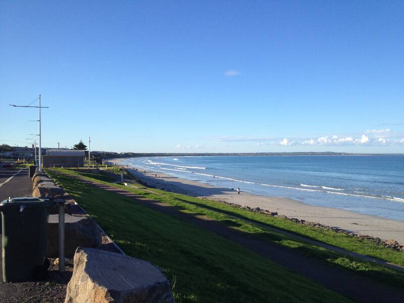
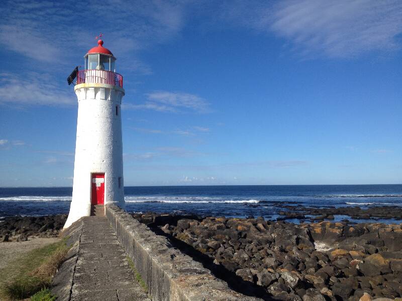
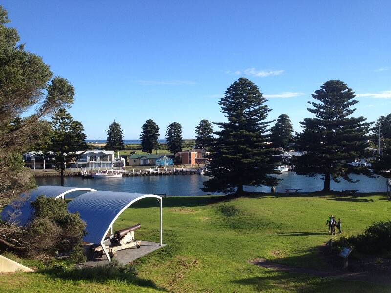
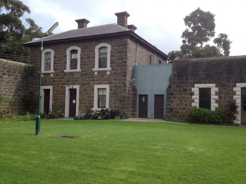
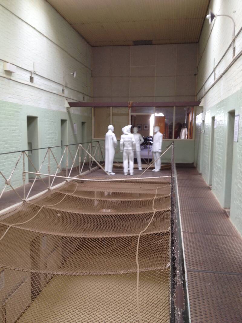
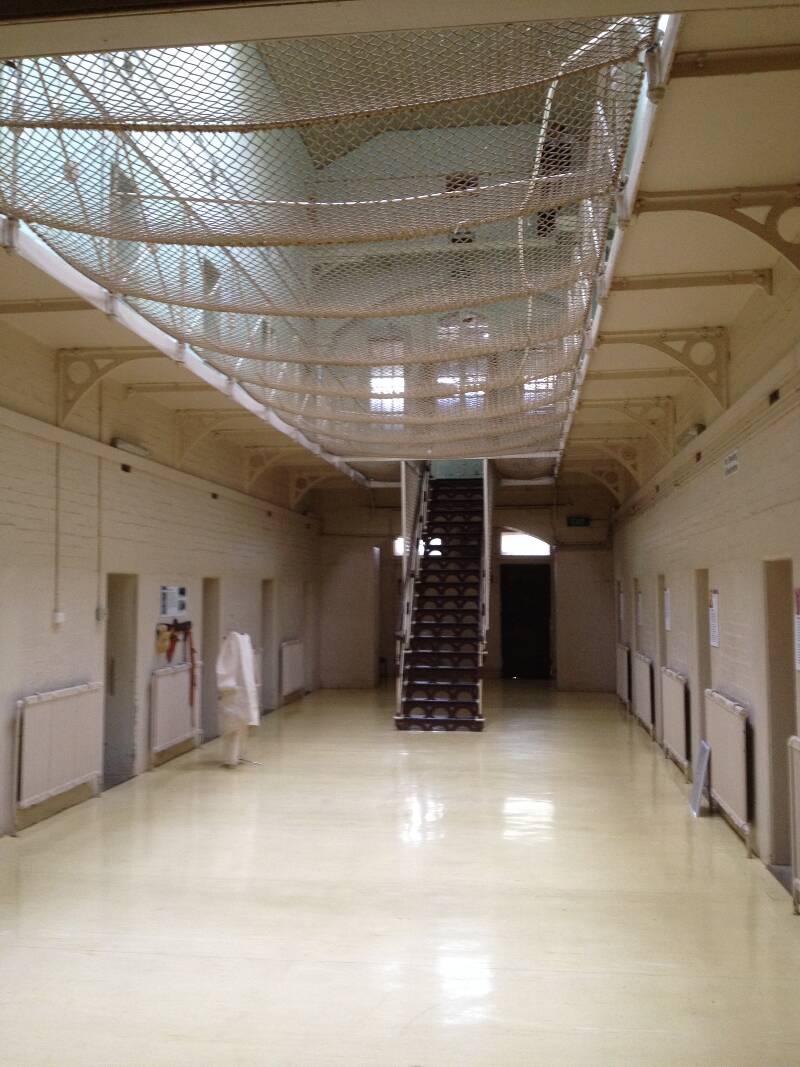
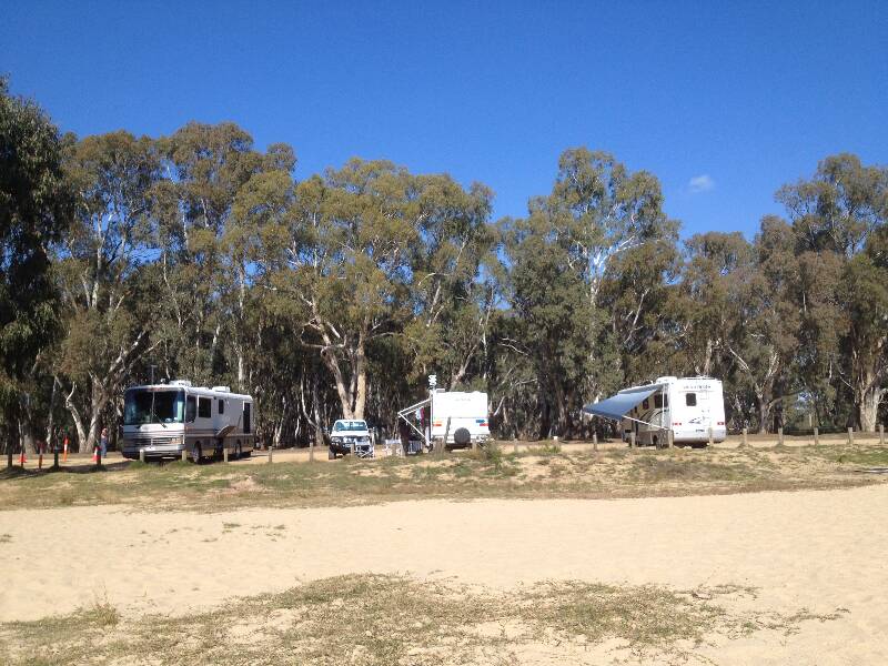
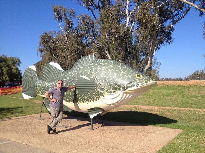
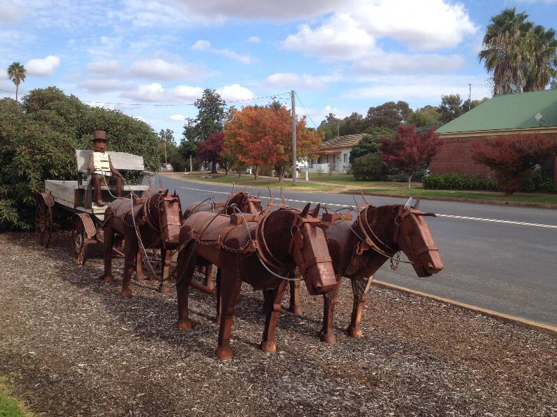
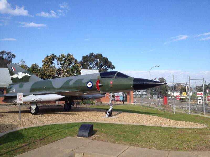
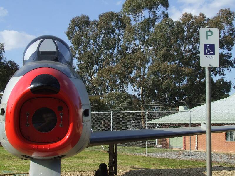
Leaving Canberra we headed west and south in a zig zag pattern which will take us through New South Wales, Victoria and South Australia Leaving the campgrounds EPIC, we headed for Wagga Wagga only 240 km away. New South Wales and especially Victoria are compact states and we are expecting to travel shorter distances between stops. We back tracked along the Barton Hwy then took the off ramp to the left onto the Hume Hwy. We have passed the turn off to Wagga a few times over the years and for some reason in my mind, always expected to climb over lots of hills to get there. I was quite surprised as the only hill we really needed to tackle was getting off the Hume Hwy. We had been close to Wagga coming from another direction when visiting Junee in 2014, we wanted to have a look at Wagga then but just didn't quite get there. We had no real reason to go to Wagga except to see what was there, but Wagga was on our route so decided this time to stop there. There is a nice free camp located walking distance to the centre of town, originally planned for one night but ended up stay two. The day we arrived, we took a stroll through town looking through the war memorial gardens, the local shopping area and tourist centre. We are told Wagga is the largest regional centre in NSW so there were plenty of shops. The second day, and the reason why we stayed another night, we called into the airforce museum. This is only open on certain days and is run by volunteers mainly ex service personel. The building that houses the musem was orginally to be torn down but the town rallied and it was given a new lease of life as a mueum. The building is outside the front gate of the still operating RAAF airforce base and was originally the guard house and cell block. There are artifacts from WW1 and WW2. Out the front on the lawn are a number of decomissioned airforce jets including a recently added F111. Leaving Wagga Wagga we headed first in a westerly then turned south westerly towards the Victorian/NSW border. We passed through the small town of Lockhart where we stopped for lunch. The stop was well time, being mothers day all the family rang Anne to wish her a happy mothers day which perked her up no end as she was a bit worried noone would remember. The town was small but had a number of metal sculptures where you could follow a sort of trail through town to look at them. Continuing on we eventually arrived at the Newell Hwy and turned left just north of Jerilderie. Passing through, another 50km later we arrived at the town of Tocumwal which is right on the Murray River just before you cross the bridge into Victoria. We had heard the was a great camp spot called Town Beach about 800 metres from the town centre. following the track we eventually arrived at what is essentually the shore of the river. There is no power but plenty of taps with a town water supply. For $5.00 per person, per night, we though this to be good value. We only planned to stay one night but liked it so much (and the sun was shining) we ended up staying two nights. It is still amazing me how many caravaners and other travellers are still getting round the southern states at this time of year. While it proberbly isn't as busy as the summer months there was still a fair number of campers here. The Murray River marks the border between New South Wales and Victoria and from our position we could see right across the river into the land of Victoria, not that we could see any difference as it looked pretty much the same as the side we were on. That evening we treated ourselves to a rare night out at a resturaunt, well actually the bowls club. We wanted chinese but although they advertised as being open, the Chinese Resturaunt was most definately closed, so we decided to go instead to the bowls club. It was a good job we did as they made one of the best Parmi's we have had in a while, all freshly made. Next day we took a walk into town, walking the main street we checked out local shops. We took a photo of the big fish which is a Murray Cod, then returned to the caravan for a bit of relaxing by the beach. We took the webber out and Anne used it to cook a Damper, which we had later with hot soup as our evening meal. Leaving Tocumwal, we headed across the border into Victoria, following the Newell to its end we then turned right and headed towards Echuca. We had been to Echuca before in 2014 so passed through, just using it as a fuel stop. From Echuca we then headed west. On the way we drove through the tiny town of Mitiamo where we stoped briefly for a bite of lunch. After lunch, we continued onto arriving at a town called Boort. Our main reason for stopping here is they provide a free camp at the local showgrounds, which included free power for a small donation. We needed the power to recharge the battery as there had been no sunshine. A change in weather had been predicted and were wern't going to get much sun for a while either. We ended parked next to this humungus semi trailer setup as a mobile home. The occupant's explained, they had been on the road for 13 years and were heading back towards Melbourne to catch up with family. Leaving Boort we headed South towards Ararat our intended next stop. Heading through the town of Avoca we stopped for late-ish lunch. The camping area beside the river looked nice, and we had a fully charged battery courtesy of the community of Boort, so decided to spending the night there. We took a stroll through town stopping to buy bread at the local bakery. Returning back to the van, we once again made soup for dinner and had it with freshly buttered bread we had just bought. You can tell winter is here, when you start having soup on a regular basis. It was quite cold, we ended up leaving the gas heater running through the night keeping us warm as toast in bed, This camping doesn't seem so rough. Next morning we continued onto Ararat, a long drive of 60 Km. We checked into the Arcacia Caravan Park, small but friendly we booked in for 2 night as the next 2 days will be raining which means we needed to be plugged into power. Setting up we took a walk into town down the main street before retiring for the evening. Next day the rain had arrived as forecasted. We had made plans to catch up with Jeff and Robin who we had met about two years ago in Hay. We walk into town and met them at their local shopping store, from there we went to lunch at the local RSL club before ending back at the Caravan park to finish off the day with a coffee and cake. Next morning we wanted to visit a few of the local tourist attractions before moving on So we booked an aditional night. J Ward which is part of the now unused Lunatic Asylum is open for public tours. Originally J ward was a prison before being closed. It was then reopened as a Maximum Security Ward for the crimally insane. The guide took us through the various buildings explaining what they were used for. He recounted many stories of past events, some were funny but some were also sad. We also wanted to visit the Lunatic Asylum itself on the other side of town, but there were no tours for the days we were there. From there we called into the Chinese Museum. Chinese people played a big part in these areas during the gold rush. Life in China was poor and thousands of Chinese would come to Australia to seek their fortune and hopefully return home to pay off their family debts. Because so many were coming, a landing tax of 10 pounds per head was imposed on the chinese when they disembark from a Victorian port. Because the tax was paid by the ships captain a ship loaded with chinese would berth at Robe, where they could avoid paying the tax. They would then walk to the goldfields of Bendigo or Ballarat, It was actually the chinese who were the first to discovered one of the riches gold veins in Australia, at Ararat. Leaving Ararat we headed south again to the town of Port Fairy and our friend the tailwind was once again with us. We had planed to stay in Warrnambool but decided on Port Fairy instead, only another 20Km on. The reason, we found a small caravan park which was cheaper just 3 Km out of town. The area is quite a tourist meca so parks can be quite expensive. Setting up we drove into Port Fairy. Calling into the Tourist Bureau they told us some of the attractions worth seeing. Following the road past the port we ended up Griffiths Island which is connected to the mainland via a boardwalk. Her you can walk around the island stopping at some of the beaches and the lighthouse. You can still see the foundations of the Keepers cottage which is now gone as the lighthouse is now fully automated and no longer requires a keeper. From here we drove to the other side of the port where the fishing boats come in and watched the big fat resident seal being fed scraps fron the days catches. Getting close to evening we called into a local fish and chip shop and purchased dinner, which we took to a small picnic area next to the ocean. Our main motive for stopping here is to finish the section of Great Ocean Road we missed back in November 2014. We followed the route from Warrnambool towards the coast passing through Peterburgh, then stopping frequently at the various coastal lookouts along the way. We stopped in Port Campbell for a picnic lunch the finished off this leg at the 12 Apostles where we had finished coming from the other direction last year. We then returned back via Timboon where we stopped for an icecream. From there we stopped at the Cheesery buying a block of cheese and bottle of wine. We were lucky with the weather and had clear skys the whole day although it was a bit cold. Next morning we hooked up and headed west. Passing through Portland, we were only going to stop for lunch and maybe ride the Tourist Cable Car. Stoping at the free camp we realised the Tourist Cable Car departed from here. Being such a nice spot close to town we decided to camp here for the night. The Tourist Cable Car Ride takes you for a 7km Journey past the port district and along the coast. There is a comentery about the different land marks we pass. After the ride we decided to walk back to the port and watch the woodchip trucks being unloaded in a unique manner. The trucks drive onto a platform, where they are tipped up from the front to almost a vertical position to tipp the woodchip out through the back. It looks like they are about to launch the trucks into space, the locals call them rocket launchers. After refilling the water tanks and empting the toilet we left Portland and headed north west to Mt Gambier. We took the back road through Nelson, which is a shorter distance than taking Hwy 1. There were a huge number of trucks using our road, mainly logging trucks. We worked with them, using the radio to assist with smooth passing as they were travelling faster than us And we're on a schedule. We had heard the Mt Gambier Showgrounds were the best value in town, $22 per night was a hard price to beat. Once again the weather was going to be showery with cloud cover for most of the week, the showgrounds would provide power to keep the battery charged, and more importantly, the heater running.
There were a number of attractions we wanted to look at here. We tried to work around the weather and I think we did pretty well. Calling into the Tourist Information Centre we picked up som additional tourist tidbits on where to go. There was also a free museum at the centre showing historical artifacts from the surrounding area. Out front was a replica of the HMS Lady Nelson, which sailed down the limestone coast and naming the mountain Gambier.
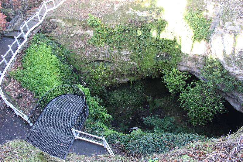
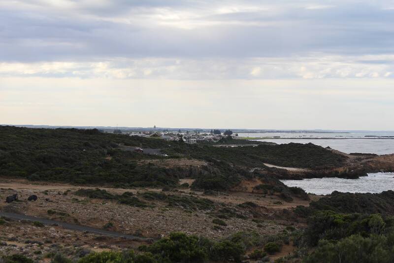
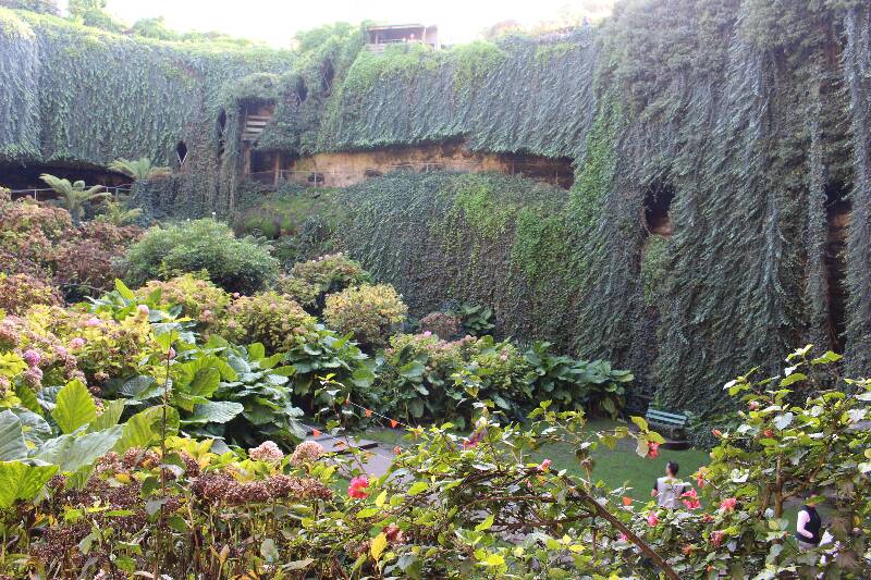
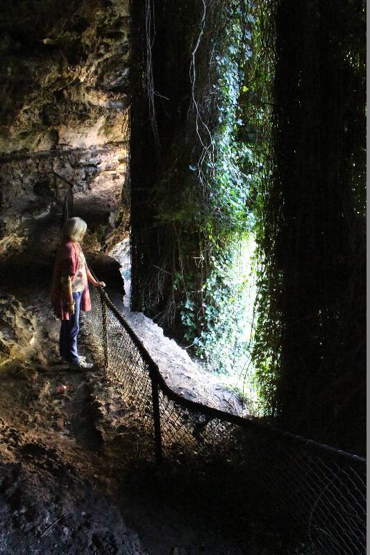
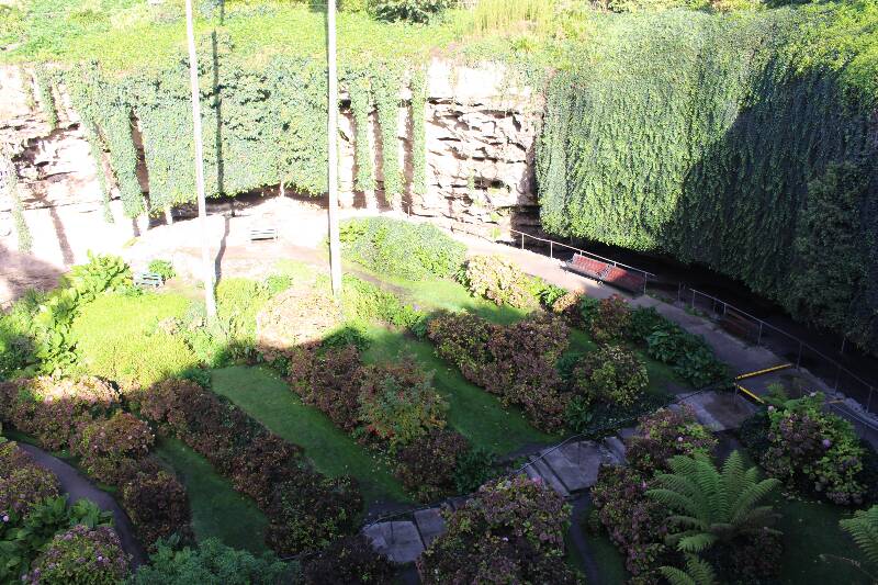
Next day the weather was much fairer so we did a round of some of the outdoor attractions. Firstly was Umperston Sinkhole which just happened to be over the back of the showgrounds. This is a limestone cave where the roof had collapsed exposing the inside. The sinkhole was originally on private land and the owner converted it into a sunken garden which was opened to the public. It was sold to the Woods and Forests Department and fell into dis-repair. In 1976 the Woods and Forests Department decided to clean it up and in 1994 handed the renovated garden over to the City Council. The Garden is well maintained and is a micro climate for various species of plants. It is once again open to the public.
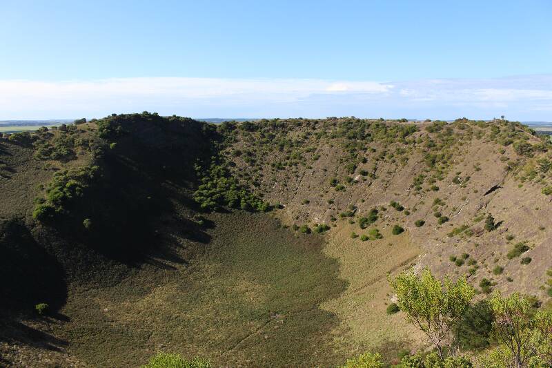
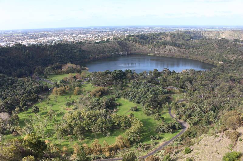
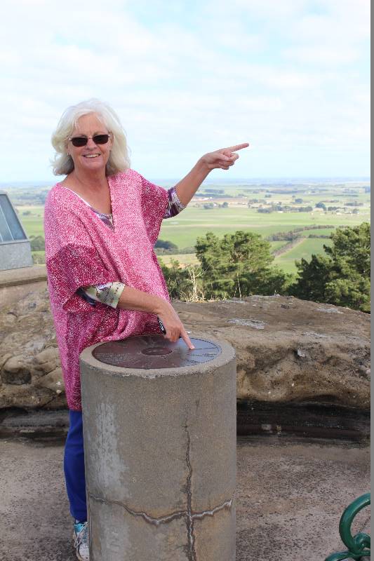
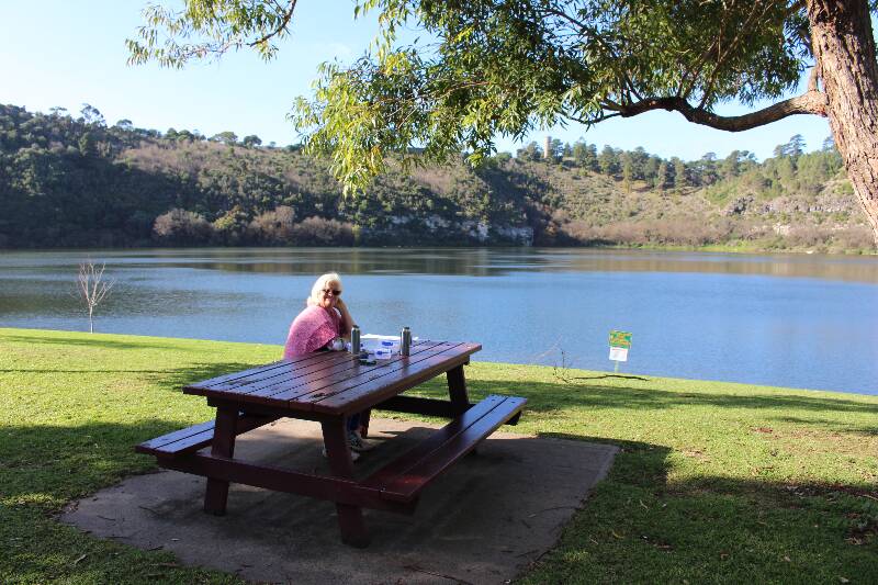
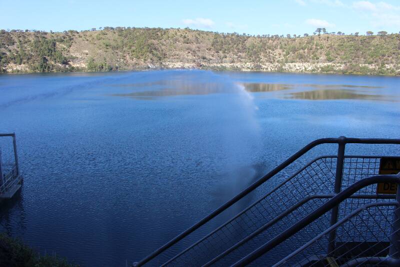
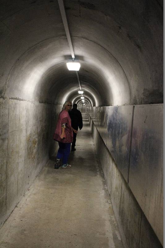
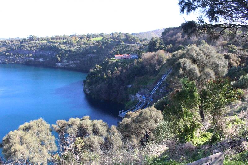
The Blue, Browne and Mutton Leg are a series of Volcanic lakes next to the city of Mt Gambier. The blue lake provides water for the city and Browne Lake is used for recreational purposes such as boating. We took a behind the scenes tour of the water works at the Blue lake. The guide takes us down a lift then through a tunnel which brings you out level with the the surface. He describes the history and current use of the lake as a water supply! showing us some of the equipment that is used help manage it. We stopped at Browne lake for a picnic lunch then climed the hill up to Centenary tower which is located on the north eastern rim of the crater. There is a great view over the town and you can see all the way to the ocean some 26 km's away.
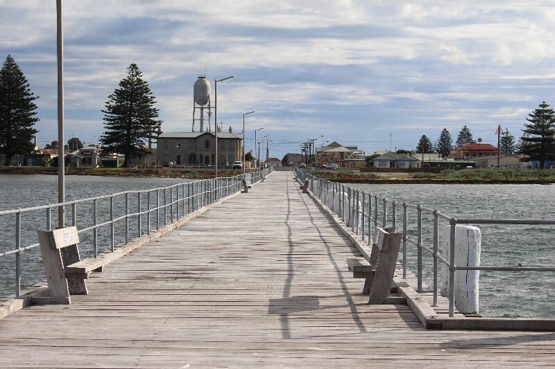
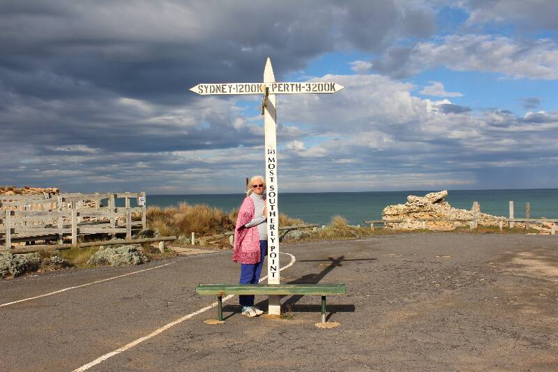
Next day was also clear so we drove to the small fishing village of McDonnell 26 km from Mount Gambier. The main attraction here is the rugged coastline and is well know as a shipreck coast. We stood and took photos of ourselves at the most southern point in South Australia. Returning back to town we took a walk out on the jetty, then walked down to the Maritime Museum where there are descriptions and artefacts, of some 30 odd shipwreck's which occurred along the rugged coast. Returning back to Mt Gambier we stopped at Mt Schank for lunch, then decided to climb to the top the took the track which circumnavigated the rim. Returning to the bottom, our next stop was the Little Blue Lake which is not a great deal larger than a hole in the ground. We met 2 SCUBA divers who were about to dive into the murky depths. We asked what was the attraction down there, with the reply being, "lots of junk, oh and an old car and a petrol pump." According to local legend, when training as a diver you are meant to dive to the bottom and read the price per litre on the bowser to prove you have been to the bottom.
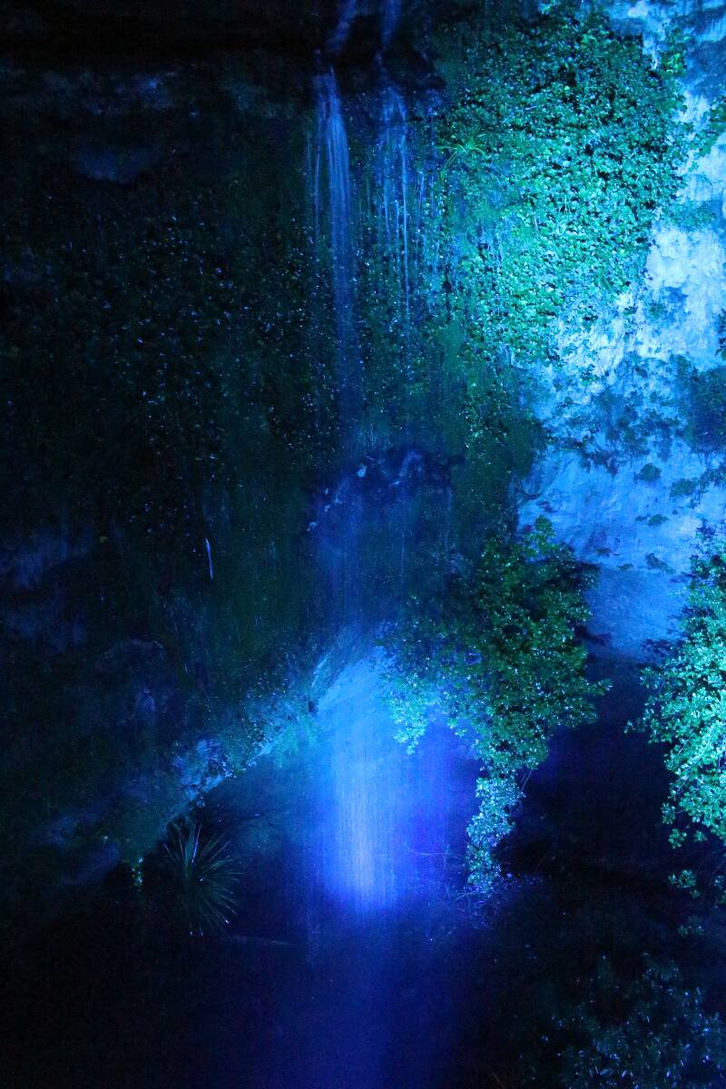
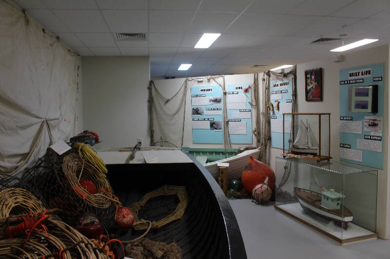
One of the last attractions we visited was Engelbrecht Cave back in town. The cave goes right under the main hwy and surrounding houses. Most of the caverns and passageways are filled with water and is a favorite for extreme cave divers. The caves are also used for training divers up to cave diving class 3. Our guide took us into the caverns that are accessable without SCUBA equipment. She explained about the history of the caves such as how they are formed, how they were used as a rubbish dump then cleaned up by the local lions club and opened to the public.
|
                                            |
Day 150 / 2017 Canberra to Mt Gambier
- Details
- Written by: Andrew